Topographical Surveying
Topographical Surveying
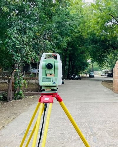
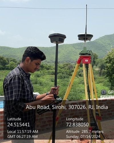
At Survey Point, we deliver highly accurate and reliable Topographical Surveying services across Rajasthan’s diverse landscapes—ranging from desert regions and rural settlements to industrial zones and rapidly developing urban areas. Using advanced technologies such as Total Station, GNSS, DGPS, LiDAR, and drone-based mapping tools, we capture precise and high-resolution terrain data that empowers architects, engineers, planners, developers, and government agencies to make informed and confident decisions.
Our expert team meticulously documents all natural and man-made features including contours, elevations, utilities, drainage lines, vegetation, buildings, water bodies, access paths, road networks, and complete terrain variations. This detailed data ensures a strong and dependable foundation for every project, regardless of scale or complexity.
We combine field expertise with advanced data processing, delivering high-clarity maps, digital models, and survey drawings that support seamless planning, error-free design, and smooth execution. Our topographical surveys serve as the first and most critical step for infrastructure development, land planning, layout design, road projects, solar plants, pipelines, industrial construction, and government works.
Our topographical surveys serve as the first and most critical step for infrastructure development, land planning, layout design, road projects, solar plants, pipelines, industrial construction, and government works.
Our Topographical Surveying Services Include:
- Detailed mapping of natural & built features
- Accurate contour and elevation surveys
- Utility, drainage & road mapping
- Digital Terrain Models (DTMs) & 3D surface mapping
- Site analysis for planning, design & construction
- High-precision data collection using Total Station, GNSS & Drone Technology
Why Choose Survey Point?
- Indian terrain expertise across urban, rural & industrial regions
- Advanced surveying equipment and professional field teams
- High-accuracy outputs and clear, detailed survey drawings
- Fast processing and timely project delivery
- Customized survey solutions for every project scale

Topographical surveys form the backbone of efficient planning and error-free execution. At Survey Point, we deliver precise, clear, and professional topographical data that ensures your project moves forward with confidence. With our advanced technology, experienced team, and deep understanding of Rajasthan’s terrain, we provide the accurate insights you need to build safely, plan intelligently, and achieve successful project outcomes—every time.